Scenarios, content and tools to create 3D related applications for virtual cultural tourism, research and education
The importance of three-dimensional (3D) and multi-temporal (i.e. 4D) city modelling is gradually increasing in the heritage domain. Historical maps are often the only source of information when dealing with large historical scenarios and 4D digital representations allow multi-temporal versions for analyses, visualisation and valorisation. These 4D reconstructions can be achieved using archival maps and machine learning methods.
Working with 3D reconstruction and visualization in architectural heritage seems like the obvious choice when thinking of showcasing the development of buildings and cities over time or digitally reconstruct lost architectural treasures from the past
Within the frame of the project the partners, under the lead of partner TMO, aim to further explore the re-use possibilities of 3D data in architectural heritage, focusing on four different use case scenarios, namely:
Virtual educational museums on city history
Virtual research infrastructure for cities
4D urban models created from historical maps
Cultural tourism
Reusing 3D Archaeological Data: Innovative Applications
The reuse of 3D archaeological data has opened up new opportunities for education, tourism, and research. Through advanced digital tools, historical city models have been integrated into various applications, allowing users to explore and interact with past environments.
Historic City Information System
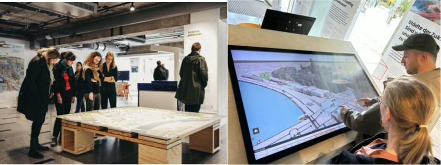
This use case combines the toolkits for creating large scale digitised historical 3D maps of cities, for predicting building height using AI-based methods, the automatic geo-location and orientation pipelines for historical photographs and the tools for mobile and desktop access and visualisation. These models serve as the foundation for location-based content in tourism and heritage information systems. The project showcased its work at major events such as the COSMO Exhibition in Dresden, Researchers' Night in Jena, Digital Gipfel 2023, and the Interactive Science Lab in Dresden. In total, 6,430 models of Trento and 364 models of Dresden and Jena were ingested into the Data Space, ensuring open access with high metadata quality. The 4D City Browser and 4DCity applications enable users to explore these models through desktop, mobile, AR, and VR platforms.
Figure 1. COSMO exhibition space; Dresden model in the 4D Browser shown there.
This scenario highlights the transformation of 3D models into educational resources, focusing on the historic Vaalkenbourg quarter in Amsterdam from the 17th to 19th centuries. The project digitized over 200 buildings and integrated them into Europeana through Zenodo to enhance historical education. These reconstructions provide insights into Amsterdam’s urban transformation and are available for academic and public engagement.
Figure 2. Screenshot of the National Maritime Museum in Amsterdam in the 4D Browser (left) and 4D City (right).
The city of Sion, Switzerland, has been turned into a virtual research environment, enabling historians and genealogy researchers to explore its past from three significant historical periods (1630, 1770, 1820). A total of 1,359 models were integrated into the 4D City Browser, enriched with metadata and genealogical records. These reconstructions support academic research by providing a detailed view of Sion’s historical evolution and urban development.
The purpose of this use case was to showcase how existing 3D cultural heritage content, sourced from platforms like Europeana, can be repurposed to promote cultural tourism for smaller Destination Management Organizations (DMOs) or/and museums and other tourist providers at smaller destinations. Given the budget and resource constraints faced by smaller DMOs, reusing existing content is a necessity for a cost-effective and efficient approach.
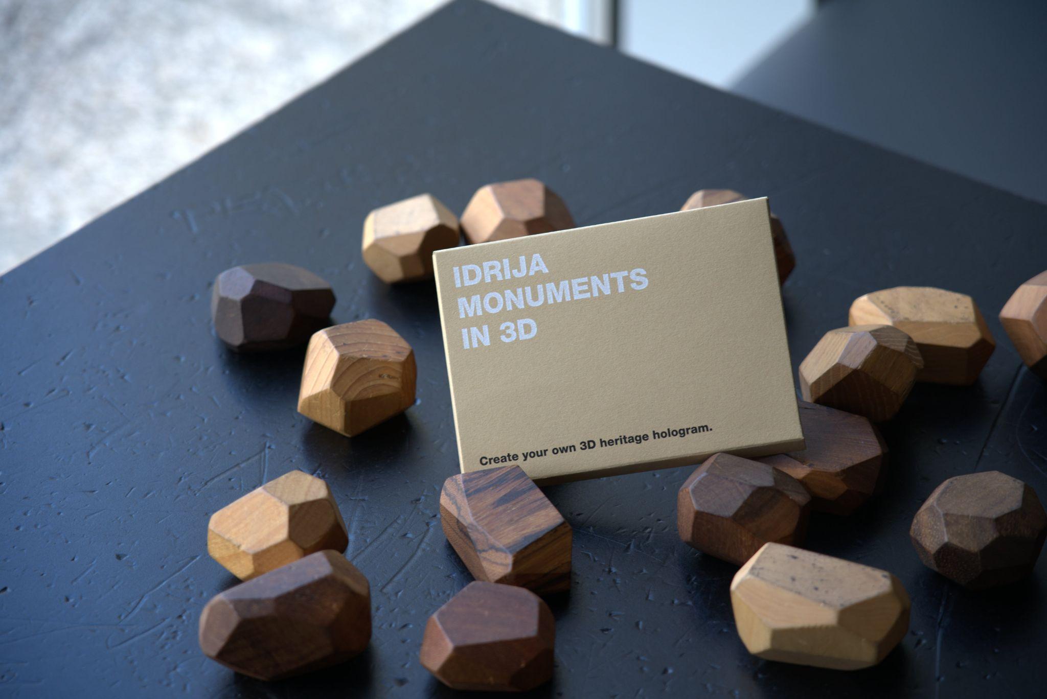
Within this use case, the pilot location was Idrija, a UNESCO-listed former mercury mining town in Slovenia. In 2020 and 2021, the Idrija Tourism Board, Idrija Municipal Museum, and Idrija Mercury Heritage Management Centre were involved in a national initiative called Digital Innovation of Cultural Heritage. This initiative aimed to 3D digitize emblematic cultural heritage monuments across Slovenia and develop novel tourist products and experiences using technologies such as Virtual Reality, Augmented Reality, holograms, and video mapping.
In Idrija, 3D models were created of the Idrija Kamšt, a large water-powered pumping device, and a reconstruction of a colossal rotary kiln for smelting cinnabar ore. Arctur, a high-tech company from Slovenia and also a partner in the 5DCulture project, digitally captured these two UNESCO World Heritage sites using photogrammetry, laser scanning, and 3D modeling. They subsequently developed an Augmented Reality app for the Idrija Kamšt and a Virtual Reality experience for the rotary kiln. Several years prior, a 3D model of the Idrija Klavže water barriers had been created in a collaboration between the Idrija Mercury Heritage Management Centre and Arctur, one of the first of its kind in Slovenia.
The use case required easy-to-implement, low-cost hardware, hybrid storytelling solution that would re-use the existing 3D models, texts and photos, primarily directed toward cultural tourism visitors.
The solution
The proposed solution involves a micro-storytelling campaign that combines physical and digital elements:
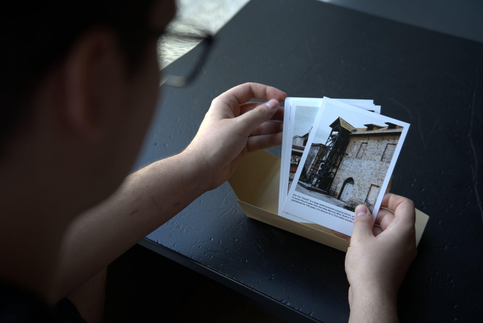
Physical postcards, featuring 3D visualizations and QR codes, serve as tangible promotional materials.
Digital landing pages, created using the WeaveX tool, provide an immersive online experience.
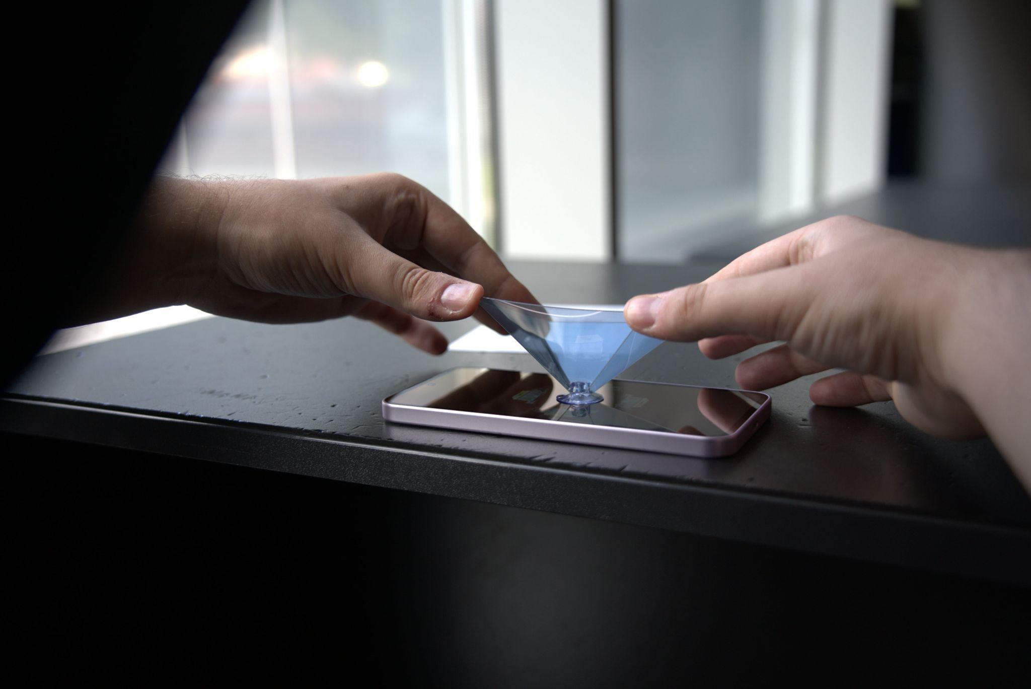
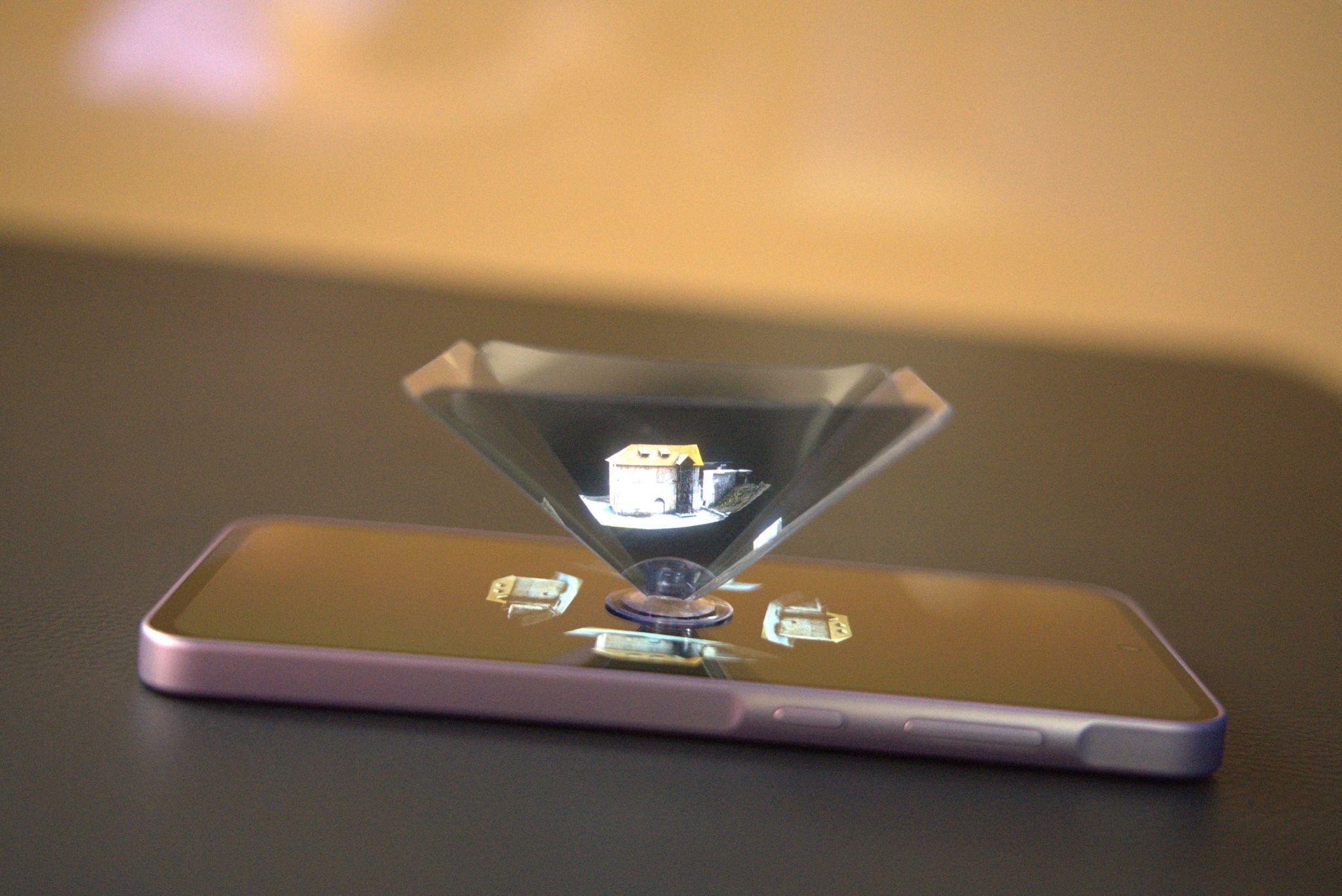
A physical holographic pyramid enables the user to turn the mobile phone into a hologram projection device.
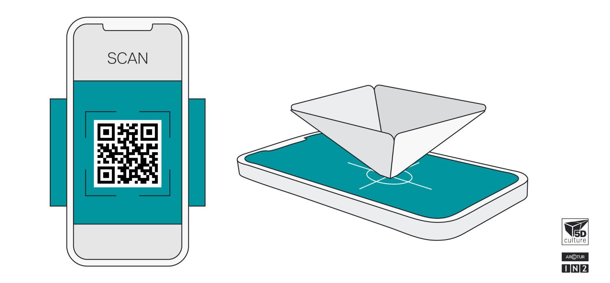
Figure 1. Explanatory graphics for QR scanning and holographic pyramid
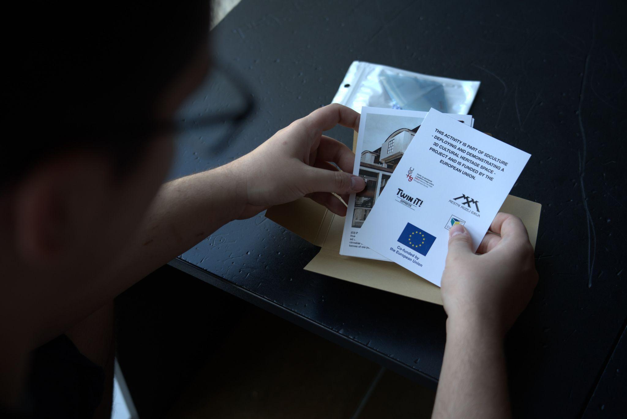
Figure 2. A set of photos of the process of opening holographic postcards package.
Read more about the 3D heritage asset manager and storage capabilities here
Lessons learned
Based on the interviews with Damjana Bončina from Idrija Municipal Museum and Davor Vodopija from Idrija Mercury Heritage Management Centre, holographic postcards have shown potential as a tool to enhance visitor experiences and promote cultural heritage. However, their effectiveness depends on various factors, including design, presentation, and user experience.
Strengths
Unique and Engaging: Holographic postcards offer a unique and engaging way to present information, capturing the attention of visitors, particularly younger generations.
Educational Potential: They can convey complex information in a simplified and engaging manner, making it easier for visitors to understand and appreciate cultural heritage.
Affordability: The production of holographic postcards is relatively affordable, making them a cost-effective tool for visitor engagement.
Weaknesses
Technical Limitations: Some users may encounter technical difficulties, such as issues with device compatibility or internet connectivity.
Packaging and Presentation: The packaging and presentation of the postcards can significantly impact their perceived value and attractiveness to potential buyers.
Limited Impact on Visitor Behavior: While they can enhance the visitor experience, their impact on visitor behavior, such as increasing visits or purchases, may be limited.
Interested to try this out yourself?
Take the self paced training course on Europeana Academy or send us an email with your address to receive a package in the post (subject to availability). Or you can discover now the digital stories on WeaveX:
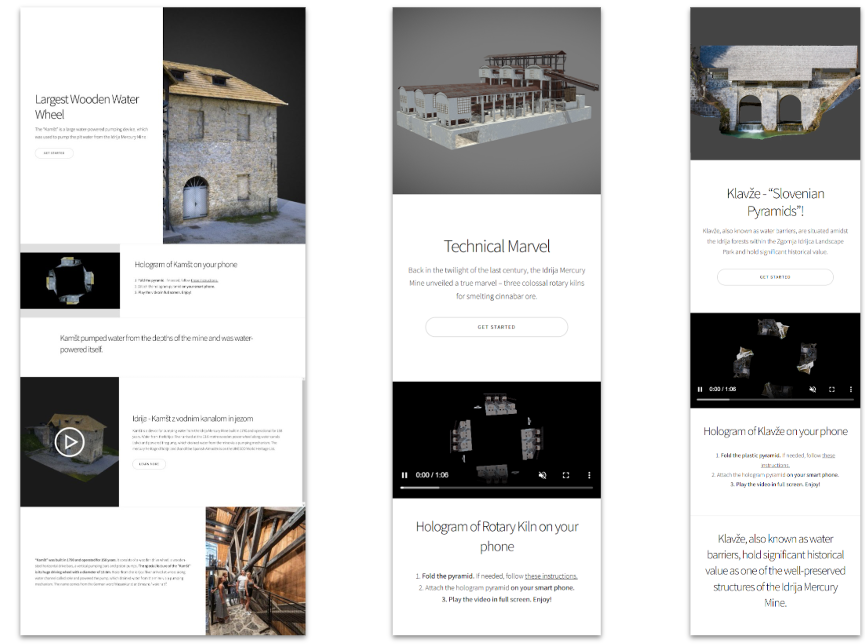
Largest Wooden Water Wheel: The “Kamšt” is a large water-powered pumping device, which was used to pump the pit water from the Idrija Mercury Mine.
Read more
Technical Marvel: Back in the twilight of the last century, the Idrija Mercury Mine unveiled a true marvel – three colossal rotary kilns for smelting cinnabar ore.
Read more
Klavže - “Slovenian Pyramids”! Klavže, also known as water barriers, are situated amidst the Idrija forests within the Zgornja Idrijca Landscape Park and hold significant historical value.
Read more
You can also check out our presentation “From Postcard to Hologram” at the 17th International Conference for Cultural Tourism Europe
Figure 3. Digital stories within the WeaveX platform.
After two years of international cooperation, the 5Dculture project has achieved a remarkable transformation in how European cultural heritage is preserved, shared, and reimagined through the power of 3D technologies. Looking back, the project has delivered tangible results that ...
On November 28, 2024, the Ibero Museum of Jaén (Spain) and 5Dculture inaugurated an inclusive experience titled TOUCH, SEE, HEAR. AN INCLUSIVE EXPERIENCE WITH IBERIAN HERITAGE IN 3D. The exhibition presents the novelty of being aimed at diverse audiences: people with visual, audi...
From 25 to 29 November, the Europeana Initiative invited the community to join an extensive online event highlighting the efforts and expertise of the data space consortium active in diverse and innovative projects enriching the common European data space for cultural heritage. ...